


-

During the 2022-2023 school year, all students at Harding will be issued Metro Transit Go-To cards. Students whose IEP qualifies them for special transportation will take yellow school buses. For everyone else, here are some resources to help you plan how you will get to school.
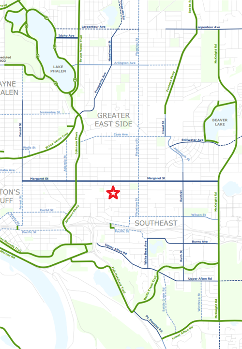
Transportation Map
This map shows bike routes and transit lines near Harding, with the closest stops highlighted. Click on the bus icons to see bus times and walking distances. To plan your trip, visit metrotransit.org or download the Metro Transit app on your mobile device.
Any questions about directions? Call the main office at (651)793-4700.
Taking the bus
Biking and walking to school
Biking and walking on the East Side is very pleasant! If you live close enough to Harding to so, we encourage you to bike or walk to school. Here are some resources to help:
Above is a cropped version of the Saint Paul Bicycle Coalition's map of bike routes. Click here to see the full version for the whole city.
Building map
Download a building map of Harding.
Select a School...
Select a School
- Adams Spanish Immersion School
- AGAPE
- American Indian Magnet School
- Battle Creek Elementary School
- Battle Creek Middle School
- Benjamin E. Mays IB World School
- Bridge View School
- Bruce Vento Elementary School
- Capitol Hill Gifted and Talented Magnet
- Central Senior High School
- Chelsea Heights Elementary
- Cherokee Heights Elementary School
- Como Park Elementary School
- Como Park Senior High School
- Creative Arts Secondary School
- Crossroads Elementary Science + Montessori Schools
- Dayton's Bluff Achievement Plus Elementary
- Eastern Heights Elementary School
- Expo for Excellence for Elementary
- Farnsworth Aerospace Lower
- Four Seasons A+ Elementary
- Frost Lake Elementary
- Early Childhood Hubs
- Gordon Parks High School
- Groveland Park Elementary School
- Hamline Elementary School
- Harding Senior High School
- Hazel Park Preparatory Academy
- Hidden River Middle School
- Highland Park Elementary School
- Highland Park Middle School
- Highland Park Senior High School
- Highwood Hills Elementary School
- Horace Mann School
- Humboldt High School
- J.J. Hill Montessori Magnet School
- Farnsworth Aerospace Upper Campus
- Jie Ming Mandarin Immersion Academy
- Nokomis Montessori South
- Johnson Aerospace & Engineering High School
- L'Etoile du Nord French Immersion School
- LEAP High School
- Global Arts Plus
- Maxfield Elementary School
- Mississippi Creative Arts School
- Murray Middle School
- Nokomis Montessori North Campus
- East African Elementary Magnet
- Open World Learning Community
- Txuj Ci HMong Language and Culture - Upper Campus
- Txuj Ci HMong Language and Culture - Lower Campus
- Randolph Heights Elementary School
- Riverview Spanish/English Dual Immersion Program
- Saint Paul Music Academy
- St. Anthony Park Elementary School
- The Heights Community School
- Washington Technology Magnet School
- Wellstone Elementary
- Community Education
- Referendum 2018
- E-STEM Middle School
- SPPS Online School
- RiverEast Elementary and Secondary School
- Focus Beyond
- Athletics
- STAFF | SPPS
- ADULT BASIC EDUCATION
- Technology Services
